Navigating FEMA Flood Maps: What Galveston Homeowners Need to Know Before Breaking Ground
Understanding your property’s flood zone can save you thousands of dollars and prevent construction mistakes. Elevating just 1 foot above Base Flood Elevation can reduce annual flood insurance premiums by 30%, according to the National Flood Insurance Program. For Galveston homeowners planning new construction or major renovations, navigating FEMA flood maps Galveston requirements is essential before breaking ground.
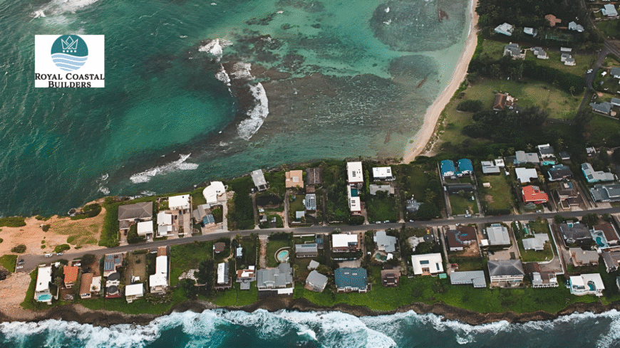
At Royal Coastal Builders, our 50+ years on Galveston Island have taught us how flood maps affect every construction decision. From foundation design to insurance costs, understanding your flood zone shapes your entire project. This guide breaks down what Galveston homeowners need to know about FEMA flood maps.
What Are FEMA Flood Maps?
FEMA Flood Insurance Rate Maps (FIRMs) identify areas at risk of flooding and establish Base Flood Elevation requirements. These maps determine building codes, insurance rates, and construction methods for coastal properties.
Why Maps Matter:
Galveston’s location on a barrier island puts most properties in high-risk flood zones. The FEMA Flood Map Service Center provides official flood maps showing where flooding is likely during major storms. More than 20% of flood insurance claims come from properties in low-risk zones, proving that understanding your actual risk matters even outside high-risk areas.
The City of Galveston updated its flood maps in 2019, changing elevation requirements and flood zones throughout the island. Properties built before 2019 may not meet current standards, affecting renovation and insurance costs.
Understanding Galveston Flood Zones
FEMA designates flood zones using letter codes that indicate flood risk levels and building requirements.
High-Risk Zones:
Zone VE covers most beachfront properties. The V stands for velocity, meaning wave action during flooding. These areas face the highest risk and strictest building requirements. Homes must be elevated on pilings with breakaway walls below.
Zone AE includes areas with 1% annual flood chance but less wave action than VE zones. Most of central Galveston falls into AE zones. Elevation is required but foundation options are more flexible than VE zones.
Zone AO indicates shallow flooding areas where water depths of 1-3 feet are expected. These zones require elevation but typically less height than VE or AE zones.
Moderate to Low-Risk Zones:
Zone X (shaded) represents areas with 0.2% annual flood chance. While risk is lower, flooding still occurs. Mortgage lenders may not require insurance, but protection is still wise.
Zone X (unshaded) shows minimal flood risk. These areas are above the 500-year floodplain. Insurance costs are low but not zero, as climate patterns change and development affects drainage.
What the 100-Year Flood Really Means:
A “100-year flood” doesn’t mean flooding once per century. It means a 1% chance of that flood level occurring in any given year. Over a 30-year mortgage, there’s actually a 26% chance of experiencing a 100-year flood. This probability explains why insurance remains important even in moderate-risk zones.
Base Flood Elevation Requirements
Base Flood Elevation (BFE) represents the water level expected during a 100-year flood event. New construction must elevate the lowest floor above BFE.
Galveston BFE Standards:
BFE varies across Galveston Island from 8 to 18 feet depending on location and storm surge projections. Beachfront properties face higher BFE requirements than bay-side or inland locations.
The City of Galveston Building Department enforces these requirements strictly. Homes built below BFE face permit denials, insurance penalties, and vulnerability during storms.
Elevation Certificate Requirements:
An Elevation Certificate documents your home’s height relative to BFE. Licensed surveyors create these certificates showing lowest floor elevation, foundation type, and flood zone. Providing an Elevation Certificate can lower insurance costs by $600-$1,100 annually by proving your home sits higher than maps assume.
New construction requires Elevation Certificates before final inspections. The certificate becomes part of your permanent property records, affecting future sales and insurance.
Building Above Minimum:
Smart builders construct 2-3 feet above minimum BFE. This extra elevation dramatically reduces insurance costs and flood risk. The additional foundation cost of $8,000-$15,000 pays for itself through lower premiums within 5-7 years.
How Flood Zones Affect Construction
Your flood zone determines foundation type, construction methods, and allowable uses.
Foundation Requirements by Zone:
VE zones require pile or column foundations only. No fill foundations or solid walls below BFE are permitted. Pilings must be driven deep enough to resist scour from wave action.
AE zones allow pile foundations or properly engineered fill with stem walls. Many builders still prefer pilings in AE zones for maximum protection and better insurance rates.
Breakaway walls in enclosures below BFE must collapse under wave pressure without damaging the main structure. Improperly designed breakaway walls cause foundation failure when they don’t release as intended.
Flood Vents:
Enclosed areas below BFE need flood vents allowing water to enter and exit freely. This prevents pressure buildup that can push structures off foundations. One square inch of vent per square foot of enclosed area is required.
Modern flood vents include screens preventing pest entry while maintaining proper flow. Installation location and height matter for code compliance and insurance credits.
Utilities and Mechanical Systems:
HVAC units, water heaters, and electrical panels must be elevated above BFE or protected from flooding. Ground-level mechanical rooms in high-risk zones face insurance penalties and damage risk.
Our HVAC installation services include proper elevation planning, while our electrical work ensures panels and circuits meet flood zone requirements.
Flood Insurance Costs by Zone
Insurance costs vary dramatically based on flood zone and elevation.
Current Premium Ranges (2026):
VE zones: $2,500-$8,000 annually depending on elevation and coverage AE zones: $1,500-$4,500 annually X zones (shaded): $600-$1,500 annually X zones (unshaded): $400-$800 annually
These ranges assume homes built to current standards. Pre-FIRM homes (built before 1977) often pay significantly more due to grandfathered rates being phased out.
Elevation Impact on Premiums:
Building 1 foot above BFE reduces premiums approximately 30%. Building 2 feet above BFE can cut costs 50% or more. Building 3 feet above BFE provides maximum savings and storm protection.
For a home in AE zone paying $3,000 annually at minimum elevation, building 2 feet higher reduces premiums to approximately $1,500 annually. Over 30 years, that’s $45,000 in savings for a foundation modification costing $10,000-$15,000.
Risk Rating 2.0 Changes:
FEMA’s updated rating system considers individual property characteristics beyond just flood zone. Distance from water, elevation, replacement cost, and flood history all factor into premiums. This means similar homes in the same zone may have different rates.
Reading Your Flood Map
Learning to read FEMA maps helps you understand your property’s specific risks.
Online Map Tools:
The official FEMA Map Service Center lets you search by address. Enter your Galveston property address to see current flood zone, BFE, and map panel number.
The City of Galveston provides GIS-based maps with additional information including storm surge zones, historical flood data, and wetland locations. These tools help visualize risk beyond basic FEMA designations.
Map Panel Information:
Each FEMA map panel includes BFE numbers shown in feet above sea level. Find your property on the map, then check nearby BFE elevation markers. Your home must be built above this elevation.
Zone boundaries show exactly where high-risk areas begin. Properties near zone boundaries should verify exact location, as being just inside a high-risk zone versus outside affects insurance and building requirements.
Letters of Map Amendment (LOMA):
If you believe your property is incorrectly mapped, you can apply for a LOMA. This formal process removes properties from high-risk zones when evidence proves lower elevation than maps show. Successful LOMAs eliminate mandatory insurance requirements and reduce premiums.
Working with Experienced Builders
Understanding flood maps is just the first step. Implementation requires builders familiar with Galveston requirements.
What Quality Builders Provide:
Site evaluation determines exact BFE requirements for your lot. Every property differs, and professional assessment prevents costly mistakes. Soil conditions, drainage patterns, and nearby structures all affect optimal elevation.
Foundation design matching your flood zone ensures code compliance and insurance eligibility. Our custom home building services include complete foundation engineering appropriate for your specific zone and elevation requirements.
Permit navigation through City of Galveston processes prevents delays. Experienced builders know what documentation inspectors expect and can address concerns quickly.
Questions to Ask Your Builder:
What is the exact BFE for my property? Generic answers aren’t acceptable. Your builder should verify the specific elevation requirement from current maps.
What elevation do you recommend building to? Quality builders suggest exceeding minimum BFE for insurance savings and storm protection.
How will you document elevation for insurance purposes? Proper documentation is essential for rate calculations and future sales.
What foundation type best suits my flood zone and budget? Different approaches work for different situations. Your builder should explain options with realistic cost comparisons.
Special Considerations for Renovations
Existing homes face different requirements than new construction.
Substantial Improvement Triggers:
Renovations costing more than 50% of the home’s value trigger substantial improvement rules. This forces the entire structure to meet current flood zone requirements, potentially requiring elevation of existing homes.
Before starting major renovations, get a market value assessment. If your $300,000 home needs $200,000 in work, you’ll cross the 50% threshold and face expensive elevation requirements.
Grandfathered Status:
Homes built before 1977 or before maps changed often have grandfathered insurance rates. Substantial improvements can eliminate this status, dramatically increasing insurance costs. Consult with insurance agents before major projects.
Our kitchen remodeling and bathroom remodeling services include analysis of how improvements affect substantial improvement calculations.
Storm Damage and Map Changes
Hurricanes can change flood maps and requirements.
Post-Storm Updates:
After major storms like Hurricane Ike, FEMA reassesses flood risks and updates maps. The 2019 Galveston map update resulted from post-Ike analysis showing higher storm surge than previously expected.
When maps change, existing homes don’t need immediate modifications. However, insurance rates adjust to reflect new risk assessments. New construction and substantial improvements must meet updated requirements.
Emergency Repairs:
Storm damage repairs not exceeding 50% of home value avoid substantial improvement rules. Our emergency services help homeowners navigate post-storm repairs while preserving grandfathered status when possible.
Conclusion
FEMA flood maps shape every aspect of Galveston construction from foundation design to insurance costs. Understanding your property’s flood zone, BFE requirements, and insurance implications prevents expensive mistakes and ensures proper protection.
The key takeaways for Galveston homeowners are checking your exact flood zone and BFE before purchasing property or planning construction, building 2-3 feet above minimum BFE for insurance savings and storm protection, obtaining professional Elevation Certificates to document proper construction, and working with experienced coastal builders who understand Galveston flood requirements.
Don’t let flood zone confusion delay your project or increase your costs. Small investments in proper planning and construction save thousands in insurance and protect your investment for decades.
Ready to start your Galveston construction project? Contact Royal Coastal Builders today for a free consultation. Our 50+ years on Galveston Island give us deep expertise with FEMA flood maps, elevation requirements, and insurance optimization. We’ll evaluate your specific property, explain your flood zone requirements, and design the optimal solution for your FEMA flood maps Galveston project.
Frequently Asked Questions
How do I find my property’s flood zone?
Visit the FEMA Map Service Center at msc.fema.gov and enter your address. You can also contact the City of Galveston Development Services at 409-797-3814 for assistance interpreting maps.
Can my flood zone change?
Yes. FEMA updates maps periodically based on new data, development patterns, and storm damage. The most recent Galveston update occurred in 2019 with significant changes throughout the island.
Do I need flood insurance if I’m not in a high-risk zone?
Lenders can’t require it in low-risk zones, but coverage is still wise. More than 20% of flood claims come from properties outside high-risk areas. Premiums are affordable in low-risk zones.
What if I disagree with my flood zone designation?
Apply for a Letter of Map Amendment (LOMA) if you have evidence your property is higher than maps show. This requires professional surveying and engineering documentation.
How much does an Elevation Certificate cost?
Licensed surveyors charge $500-$1,000 for Elevation Certificates in Galveston. This one-time cost can save hundreds to thousands annually in insurance premiums.
Can I build a basement in Galveston?
Generally no. Basements below BFE in high-risk zones face severe insurance penalties and flooding vulnerability. Even in low-risk zones, high water tables make basements impractical.
About Royal Coastal Builders
Royal Coastal Builders designs and builds custom homes on Galveston Island and across the Texas Gulf Coast. With over 50+ years of combined experience, we create durable, storm-resistant homes that meet all flood zone requirements. We also offer kitchen remodeling, bathroom remodeling, HVAC installation, electrical services, and emergency storm repairs.
Build with confidence: Contact us today